Highpoint: Galtymore (1/32)
County: Tipperary (and Limerick)
Elevation: 918m
Difficulty: Moderate in good weather, with notable cliff exposure.
Route grading explained.Our route distance: about 11km round trip
Views: Spectacular

Every county in Ireland has somewhere that is the highest point you can get to in that county - be it the lofty peaks of the McGillicuddy Reeks of Co. Kerry, or a low-lying hill in the boggy midlands. Ellie and I have decided to climb all the county high points of the Island of Ireland (full list).
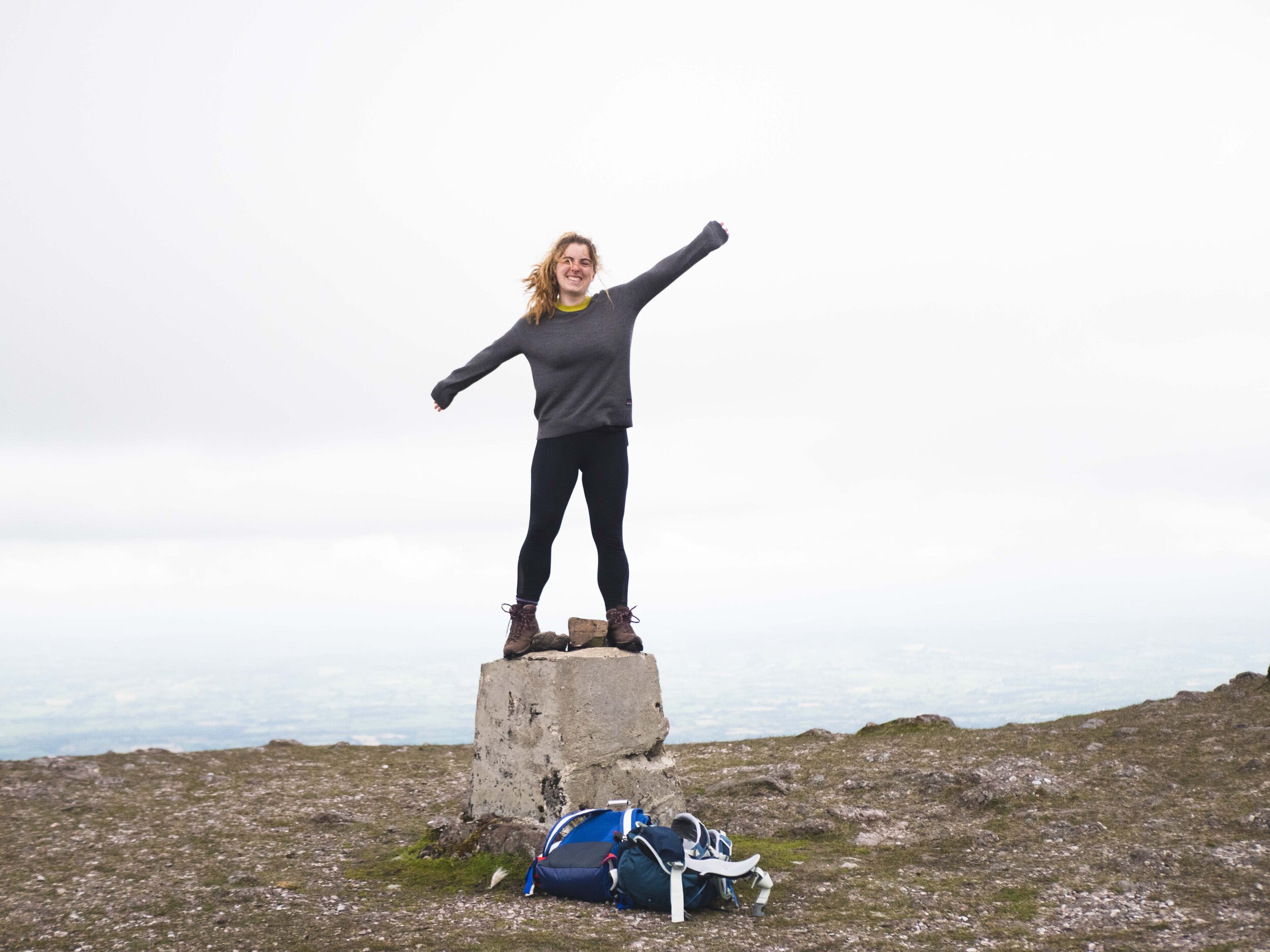
Galtymore is Co. Tipperary's highest point. It's also Limerick's highest point, which is great, since it gives us another opportunity to climb Galtymore, and try out one of the other routes up too. This was our first of the county high points, and I'm slightly worried that we might have peaked too early! Galtymore is an utterly stunning peak, with views over all of Ireland's south midlands.

There are several routes up Galtymore, and as this was our first of the high points, and we had taken a traditional Tough Soles start (ie, very late in the day), we decided to take likely the easiest of them. We parked at the Black Road car park, where there's room for maybe a dozen cars. On busier days you may need to find a layby somewhere and add a little time to your hike. From the car park, it's practically a direct route the whole way to Galtybeg, where you take a turn left and upwards to reach the summit.

We were quite lucky with the conditions on the day. It had been looking threatening all day, but besides a bit of mountainside spray for our first two hundred metres we were spared a wet journey. The peak was fully encased in cloud for our whole ascent and descent but as we approached the summit, the cloud cleared away and we were able to take in some of the best views in Ireland.

We had seen the Galtee range from the Ballyhoura Way several years ago. At the time on the trail, we thought we had gained some serious height and perhaps I felt that we'd seen it all. Looking down at the Ballyhouras, I couldn't help but feel like those early hills had only been the warm up.
The climb was hard but achievable. The start of this trail is accessible to most, but for the second half or so it's advisable to be well prepared - such as having a map and knowing how to read it, and being confident of your footing, as sunny days can quickly blow over, leaving the mountain engulfed in clouds. The final segment from the Galtybeg/Galtymore saddle to the peak is quite intense, but the ground is rocky enough to find easy seating if you need a break.

It's mostly coarse gravel and well-worn earth until the Galtybeg turn, at which point the ground becomes fairly boggy - on the day we were there it wasn’t enough to lose your shoe, but definitely enough to get your feet wet. There's some gorgeous heathland flora to be seen, and the only animals around are adventurous crows and sheep (who are almost definitely laughing at you). I did it in trail shoes that are just past their waterproofing and survived with damp feet, while Ellie wore hiking boots.
Link to YouTube video of the climb.
If you’re looking for more information, such as route details and elevation specs, make sure to check out mountain views.
To learn more about trail and hillwalking grading, click here.
To learn more about the County High Points of Ireland, click here.