
Knockmealdown Mountain is the tallest mountain in the range of the same name - the Knockmealdown Mountains. At 792m, it’s the highest point in Co. Waterford, and the 7th tallest on the County High Points list. We climbed this peak on a blustery late-April evening.
County High Point: Knockmealdown Mountain (6/32)
County: Waterford
High Point Elevation: 792m
Our starting Elevation: 340m
Total Elevation gained on the hike: 574m
Difficulty: Moderate
Learn more about trail and hillwalking grading here.Our route distance: 8.4km
Views: Top of the world (when clear)
Starting at the carpark located at the top of the Vee in the Knockmealdown Mountains, we set off east, up Sugarloaf Mountain first. The last time we had hiked up this track together was in 2018 for my birthday - at one point in my life I lived at the foothills of these mountains for several years, and it had felt high time I actually saw the top of one of them. That day, we ascended into clouds, wrapped in down jackets and hats even though it was mid-summer. At the summit, I could barely see 10 meters from the cairn. It hadn’t mattered at the time - the howling wind whipped our conversations and laughter twirling away off the mountain, and I had soaked in the feeling of being high and exposed just as much as I might have soaked in a view.
Happily, this time looked to be a new experience - the clouds were all small wisps drifting away at higher altitudes.
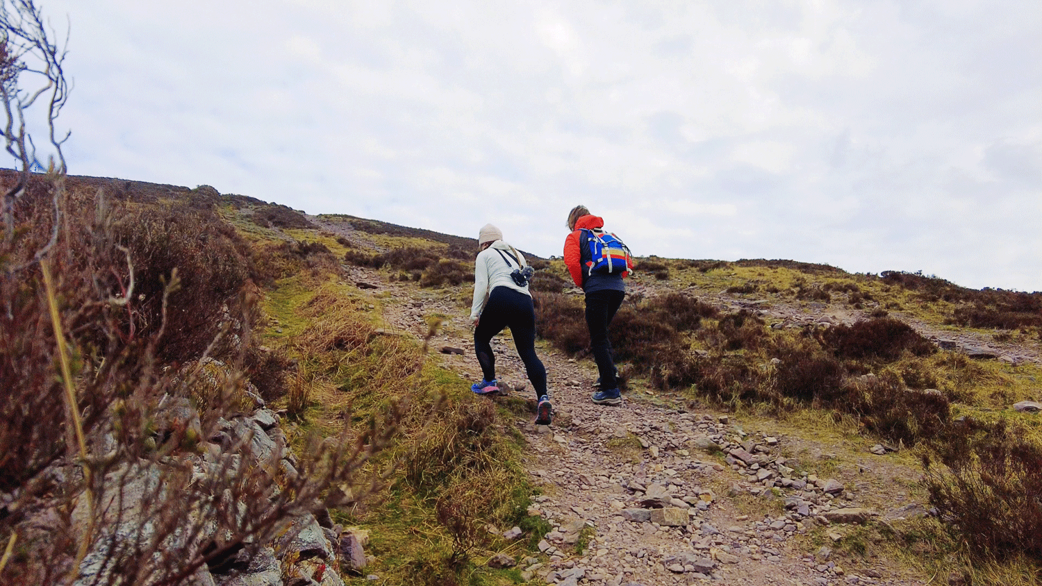
This first climb up the Sugarloaf is the hardest section of the whole hike. Following the boundary wall the trail goes straight up, and as hikers there’s nothing much to do but pant and push your way over the loose shaley stone and count off the false summits on the way (for me, there were three). We took our time on the way up as we knew we had all afternoon to get there, and once we summited the Sugarloaf we had climbed a little over 300m of the total 574m we would climb that day.
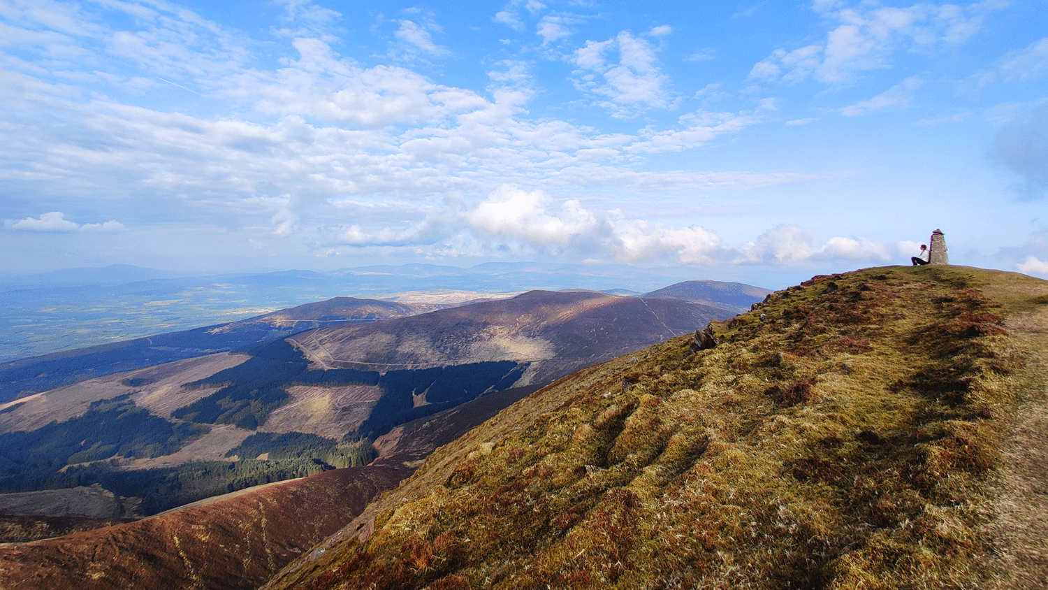
Once at the top we took in the views that we’d missed on our previous adventure, and high-fived the summit cairn. While not the summit we were out for - a summit is still a summit, and as the first one of the day it held that extra sweet feeling of accomplishment. From these mountains you can see the Galtees, Slievenamon, and the Comeraghs.
Crossing the summit, we make our way down the far side of the Sugarloaf to stunning views of Knockmealdown mountain itself. From here, the trail sweeps away from you down to the saddle between the Sugarloaf and the rest of the major Knockmealdown Mountains. On the far side of the saddle the mountains slowly rise up, sweeping leftwards with the county boundary wall acting like a ribbon along its spine.
As we climb up the more gentle slope that leads to the high point, the ground levels out for a moment as we pass a small cairn that marks the turn off for Knockmoylan, a summit slightly off the main ridge line. As we pass by Knockmoylan the ground drops off dramatically on the left hand side (northwards), creating a bowl-like valley between Knockmoylan and Knockmealdown mountain itself. The views are breathtaking, and we sit with our backs to the trig point for a while.
The wind whips our hair about us and chills any exposed skin, as the sun slightly lowers itself towards the far end of the mountain range. Heading back, we descend Knockmealdown mountain, and retrace our footsteps as far as the saddle at the bottom of the Sugarloaf. Instead of climbing over this mountain again, we track to our left, around the south side of the mountain, descending slowly until we make it back to the lowest of the “false summit” style bumps that we had climbed at the start of our hike. We follow the wall back down the last short stretch as the sun lowers itself behind the mountains in front of us, casting off unexpected rays and shadows in equal measure.


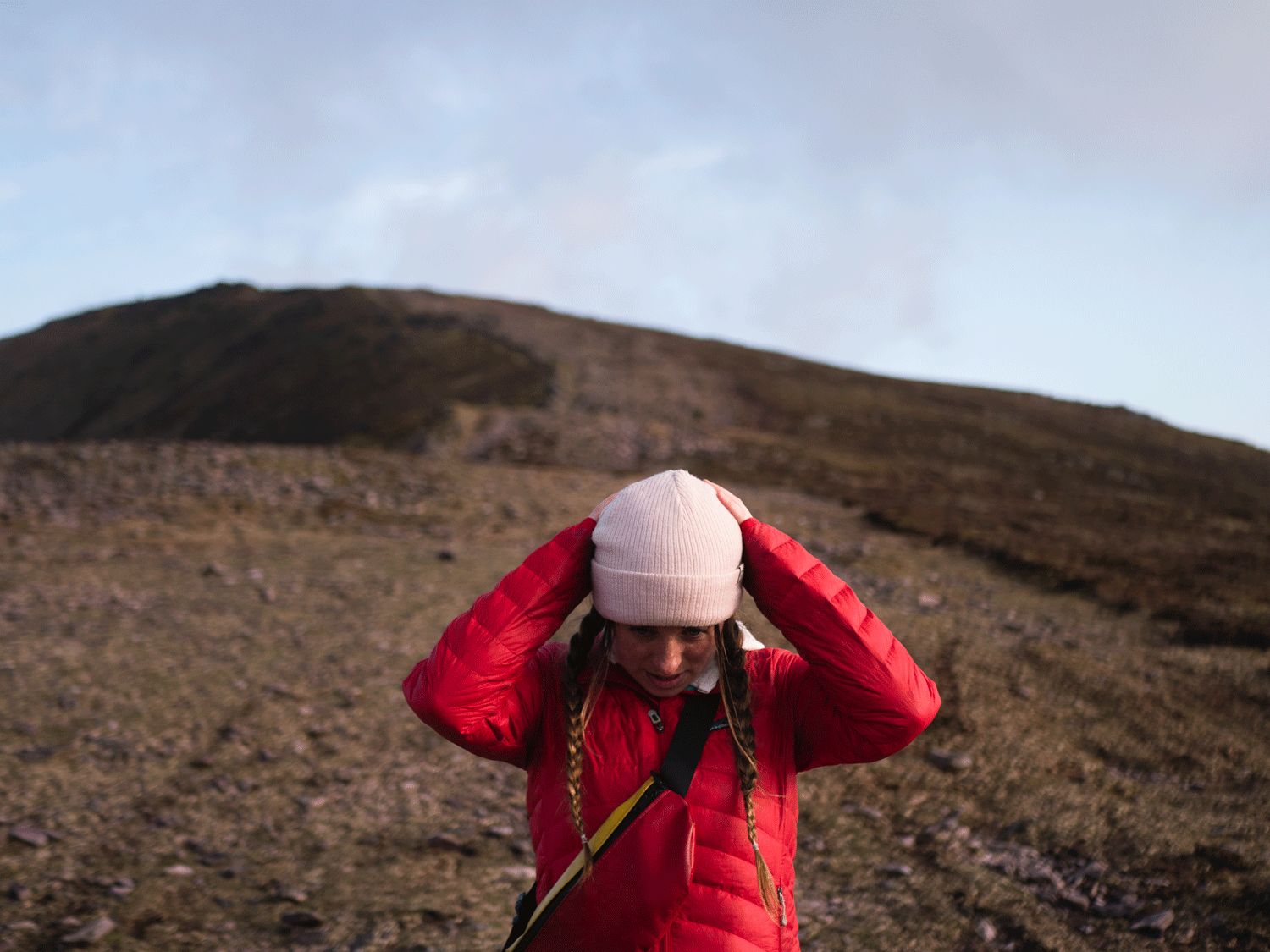


We had a beautiful evening hiking in these mountains. From our experience, these mountains are quite exposed, and pretty much always windy. Layers were key, even when we knew that we’d only be wearing something for five minutes before wanting to take it back off again. Because the mountains are exposed, the weather can change easily.
Breakdown of County High Point Difficulty Rating
Easy: These are nice hills that have marked paths or trails, and are suitable for all levels
Medium: These are larger hills or small mountains that may have marked paths, but need a basic level of fitness
Hard: These are open mountains that require some outdoor experience to climb